About Me

My photo
I am Male, 37 years of age, I loved Listening Music, I love to travel and Honest Person.

Beautiful Philippines

Dear Followers,

WELCOME! to my blog-site.

Here y0u can find beautiful places and you can get some information how to reach this paradise and where to stay for your vacation.

Happy surfing!

The Author


Powered By Blogger

Monday, November 15, 2010

Bantayan Island, Cebu, Philippines


Bantayan Island is an island in the Philippines located at the western portion of the northern tip of Cebu Island. It is politically a part of the Province of Cebu.

HOW TO GET THERE?

The island can be reached via Bus from Cebu City (via the North Bus Terminal near SM City Shopping Mall) then via Ferry from Hagnaya Wharf in Hagnaya Cebu, or from Sagay City and Cadiz City in Negros Occidental. No commercial flights or overnight ferries are currently operating from Cebu City. It is possible to charter small Private Aircraft from Mactan Airport Cebu, to the Santa Fe Airport on Bantayan Island.

Bantayan is a 2nd class municipality on Bantayan Island in the province of Cebu, Philippines.

It is the island's most populous town, with a population of 71,655 people according to the 2007 census. It is bordered to the north by Madridejos and to the southeast by Santa Fe.

Bantayan Islands is geographically in the center of the Philippines. It is located at the northwestern side of Cebu and northeastern of Negros Occidental. It is a town of Cebu and is about 80 miles from Cebu City. The main Bantayan Island is about 7 miles wide by 10 miles long. About 20 of its islets stretch for another 5 miles long with some being accessible by foot from the main island at low tide. Mostly all the ships or ferryboats coming from Mindanao or south of Cebu have to pass by Bantayan Islands on its way to Manila. The Bantayan dialect is a mixture of native Cebuano, Ilongo (Negros), Waray (Samar), Masbateño, and Boholano, but it has words it can call its own such as “kakyop, sara, kag buwas“ (yesterday, today, and tomorrow).

Bantayan Islands is considered as Cebu’s fishing ground where shiploads and boatloads of fish are transported daily to Cebu City and Negros. Tons of guinamos (salted fish) and buwad (dried fish) are delivered to Cebu City and Cadiz, Negros for further distribution to as far as Mindanao and Manila. Equally important is the thriving poultry industry with hundreds of thousands of chicken eggs produced daily.

Wednesday, July 21, 2010

Iligan City, Philippines


Limunsudan Falls

Ma. Cristina Falls


The City of Iligan (Cebuano: Dakbayan sa Iligan; Tagalog: Lungsod ng Iligan) is a highly urbanized city north of the province of Lanao del Norte, Philippines, and the province's former capital. It is approximately 795 kilometers southeast of Manila. According to the 2007 census, it has a population of 308,046 people.

The History

Iligan had its beginnings in the village of Bayug, north of the present Poblacion. It was the earliest pre-Spanish settlement of native sea dwellers. The monotony of indigenous life in the territory was broken when in the later part of the 16th century, the inhabitants were subdued by the Visayan migrants from the island kingdom of Panglao. In the accounts of Jesuit historian Francisco Combes, the Mollucan King of Ternate invaded Panglao. This caused Panglaons to flee in large numbers to Dapitan City|Dapitan, Zamboanga del Norte. In Dapitan, the surviving Prince of Panglao, Pagbuaya, received Legazpi's expedition in 1565. Later, Pagbuaya's son Manook was baptized Pedro Manuel Manook. The Christianized Manook subdued the Higaunon village in Bayug and established it as one of the earliest Christian settlements in the country. The settlement survived other raids from other enemies, and, because of their faith in God and in their patron saint, Saint Michael the Archange, the early Iliganons moved their settlement from Bayug to Iligan. The name Iligan is from the Higaonon word iligan or ilijan' meaning "fortress of defense" against frequent attacks by pirates and other hostile Mindanao tribes.

A stone fort called Fort St. Francis Xavier was built in 1642 where Iliganons sought refuge during raids by bandits. But again, the fort sank due to floods. Another fort was built and this was named Fort Victoria or Cota de Iligan. In 1850, because of floods, Don Remigio Cabili, then Iligan's governadorcillo, built another fort and moved the poblacion of the old Iligan located at the mouth of Tubod River west of the old market to its present site. Iligan was already a town of the once undivided Misamis Province in 1832. However, it did not have an independent religious administration because it was part of Cagayan de Oro, the provincial capital. It was one of the biggest municipalities of Misamis Province. In 1903, the Moro Province was created. Iligan, because of its Moro residents was taken away from the Misamis Province. Then Iligan became the capital of the Lanao District and seat of the government where the American officials lived and held office. Later in 1907 the capital of the Lanao District was transferred to Dansalan.[1]

The Spaniards abandoned Iligan in 1899, paving the way for the landing of the American forces in 1900. In 1914, under the restructuring of Moroland after the end of the Moro Province (1903–1913), Iligan became a municipality composed of eight barrios together with the municipal district of Mandulog. After enjoying peace and prosperity for about 40 years, Iligan was invaded by Japanese forces in 1942. The liberation in Iligan by the Philippine Commonwealth forces attacked by the Japanese held sway in the city until 1944 to 1945 when the war ended. On November 15, 1944, the city held a Commonwealth Day parade to celebrate the end of Japanese atrocities and occupation.[2]

Using the same territorial definition as a municipality, Iligan became a chartered city of Lanao del Norte on June 16, 1950. It was declared a first class city in 1969 and was reclassified as First Class City "A" on July 1, 1977 by virtue of Presidential Decree No. 465. In 1983, Iligan was again reclassified as a highly urbanized city.

The Geography

Iligan City is bounded on the north by the 3 municipalities of Misamis Oriental (namely Lugait, Manticao and Opol), to the south by the 3 municipalities of Lanao del Norte (Baloi, Linamon and Tagoloan) and the 2 municipalities of Lanao del Sur (Kapai and Tagoloan II), to the northeast by Cagayan de Oro City, to the east by the municipality of Talakag, Bukidnon; and to the west by Iligan Bay. This is also the 2nd largest city in Northern Mindanao next to Malaybalay City, capital of Bukidnon Province.

Known as the City of Majestic Waterfalls, there are around 23 waterfalls in and around Iligan. Among them is the Maria Cristina Falls, home of Mindanao's primary hydroelectric power station, and Limunsudan Falls.

Iligan is also the Industrial Center of the South. It produces hydroelectric power for the Mindanao region through the National Power Corporation (NAPOCOR), the site of the Mindanao Regional Center (MRC) housing Agus IV, VI and VII hydroelectric plants. It also houses industries like steel, tinplate, cement and flourmills. The National Steel Corporation, one of the largest steel manufacturers in the Southeast Asian region, now Global Steelworks International Incorporated was re-opened in 2003 after heavy setbacks resulting to its closure in 1999. Iligan along with its neighboring city, Cagayan de Oro City, are the two major components for the Cagayan de Oro-Iligan Corridor, the fastest developing area in Northern Mindanao.

To the west, Iligan Bay provides ferry and container ship transportation. East of the city, flat cultivated coastal land gives way to steep volcanic hills and mountains providing the waterfalls and cold springs for which the area is well known.

The Climate

Iligan falls within the third type of climate wherein the seasons are not very pronounced. Rain is more or less evenly distributed throughout the year. Because of its tropical location the city does not experience cold weather. Neither does it experience strong weather disturbances due to its geographical location (being outside the typhoon belt) And also because of the mountains that are surrounding the city.

Transportation

Sea

There are five shipping lines serving Manila, Cebu City, and Ozamiz City routes namely: Superferry, Cebu Ferries, Carlos A. Gothong Lines, Negros Navigation, Sulpicio Lines, and Cokaliong Shipping Lines.

Land

Rural Transit (RTMI) and Super 5 Transport are the dominant public land transportation in this City. The Integrated Bus and Jeepney Terminal (IBJT) caters trips to and from Cagayan de Oro City and various parts of Misamis Oriental, while the Southbound Bus and Jeepney Terminal caters trips to and from Dipolog City, Pagadian City, Ozamiz City, various parts of Lanao del Norte and Marawi City. The public mode of transportation withinin this city is by Jeepneys, Taxis, and Pedicabs. There is also the famous "Tartanillas" (calesas) that is also a public mode of transportation which serves through Barangay Pala-o and Barangay Tambacan. Passenger vans are also available for the various municipalities in Lanao del Norte and Lanao del Sur.

Air

Iligan City was served by Maria Cristina Airport in the late 1980s at Baloi. Aerolift, a defunct regional airline, ceased its services when its passenger plane crashed at some structures at the end of the runway of the Manila Domestic Airport in 1990 which resulted to its bankruptcy. Thus, it ended its service to Iligan's airport at Balo-i which also resulted to the closure of the airport. Philippine Airlines served the city for many years before stopping services in 1998 due to the Asian financial crisis. After a decade of not serving the city, PAL subsidiary, PAL Express, revealed in August 2008 of its interest in returning to the city with four weekly flights to Manila and three weekly flights to Cebu. However, this development did not push through with the advent of the recent US and World depression.[citation needed]

The opening of Laguindingan International Airport in 2012 which is located at Laguindingan town in Misamis Oriental, is expected to replace Lumbia Airport in Cagayan de Oro City. It is also expected to augment the city's need for a nearby airport as the new airport is only 65 kilometers away or at most 35 to 40 minutes away from Iligan. The new airport is a flagship project of the Mindanao Super Regions project of the President as a major project of the Cagayan de Oro-Iligan Corridor (CIC).

People and culture

Iligan is predominantly Christian (93.61%). Iliganons compose of the Cebuano speaking locals and the minority that compose of the Maranao, Tagalog and some other cultural minorities and immigrants from other places. It is not only rich in natural resources and industries but it is also the home of a mix of cultures, Maranaos of Lanao del Sur, Higaonons of Bukidnon, and many settlers and migrants from other parts of the country. It is known for its diverse culture.

Cebuano is the major language in the city (about 93%). The rest speak Tagalog, Maranao, Hiligaynon, Ilocano, Chavacano, and Waray-Waray. The majority of the population can speak and understand English.

Government

Iligan City is a highly urbanized city and is independent from the Province of Lanao del Norte. Registered voters of the city no longer vote for provincial candidates such as the Governor and Vice Governor unlike its nearby towns that make up the provinces as a result to its charter as a city in the 1950s.

Iligan City's seat of government, the city hall, is located at Buhanginan Hills in Barangay Pala-o. The government structure compose of one mayor, one vice-mayor and twelve councilors. Each official is elected publicly to a 3-year term and can be re-elected up to 3 terms in succession. The day to day administration of the city is handled by the city administrator.

REPUBLIC ACT No. 9724, an Act separating the City of Iligan from the First Legislative District of the Province of Lanao del Norte was approved by Pres. Gloria Macapagal Arroyo last October 20, 2009.

The Economy

The economy of Iligan is largely based on heavy industries. After the construction of Maria Cristina (Agus VI) Hydroelectric Plant by National Power Corporation (NPC, NAPOCOR) in 1950, the city experienced rapid industrialization and continued until the late 1980s. The largest steel plant in the country, National Steel Corporation (NSC), was also established during that period (Specifically in 1962).[3]

During the 1997 Asian Financial Crisis, the city experienced severe slowdown in terms of economic growth. A good number of industrial plants are closed, notably the National Steel Corporation. Its closure also created a domino effect on its ancillary industries, causing some companies to close shop while putting others in grave financial distress.[4]

The city made its economic revival with the reopening of the National Steel Corporation, named Global Steelworks Infrastructures, Inc. [GSII] on 2004. Thus, putting the city back on track.[5] On October 2005, GSII officially took a new corporate name: Global Steel Philippines (SPV-AMC), Inc. not only reflects the company's commitment to the Philippines but also presents a clear, strong, and unified brand presence for Global Steel operations in Asia, Africa, and Europe.[6]

Lessons learned from the crisis, the city government makes its move to diversify the economy. Among those are tourism, agriculture, and agribusiness. In One Town, One Product (OTOP) Project of Department of Trade and Industry, the city is producing abaca and its product lines.[7] Other proud product of Iligan are the popularly known Sukang Pinakurat, Sukang Sinarapan, and Honey-man-C.

The city has currently two call centers namely HP solutions and Cybercity services which are located inside MSU-IIT.there is also a proposed construction of Excentrix, another call center which makes the number of call centers in Iligan the largest in the Region.

The current industrial plants in operation and their locations are the following:

* Treasure Steel Corporation (Formerly National Steel Corporation) — Barangay Suarez
* Mabuhay Vinyl Corporation — Barangay Maria Cristina
* Granexport Manufacturing Corporation — Barangay Kiwalan
* Petronas Energy Philippines, Inc. — Barangay Dalipuga
* Pilmico Foods Corporation — Barangay Kiwalan
* Pilmico Iligan Feedmill — Barangay Kiwalan
* Platinum Group Metals Corporation (Formerly Maria Cristina Chemical Industries, Inc.) — Barangay Maria Cristina
* San Miguel Corporation-Iligan Coconut Oil Plant — Barangay Santa Filomena
* Refractories Corporation of the Philippines — Barangay Dalipuga
* Iligan Cement Corporation — Barangay Kiwalan
* Mindanao Portland Cement Corporation — Barangay Kiwalan
* Holcim Philippines, Inc. (Formerly Alsons Cement Corp.) — Boundary of Barangay Dalipuga and Lugait, Misamis Oriental
* Iligan Bar and Rod Mill — Barangay Suarez
* Fort Steel and Cargo - Barangay Tomas Cabili
* Global Steelworks Inc. - Barangay Suarez

Banking

Iligan City holds several banks that cater the needs for the city and the Lanao del Norte province. They are the following:

* Metro bank
* Philippine National Bank
* Bank of the Philippine Islands
* Land bank
* Philippine Veterans Bank
* Banco De Oro
* Union Bank
* China Bank
* United Coconut Planters Bank
* PBcom
* Banco Filipino
* Security Bank
* One Network Bank
* Rizal Commercial Banking Corporation
* Rural Bank of Iligan
* Saim Bank
* Allied Bank
* 1st Valley Bank

Telecommunications

Iligan City's pioneering communication company is the Maranao Telephone Company (abbreviated as MaraTel which is majority controlled by PLDT), Bayan Telecommunications Inc., Italtel, a government controlled communications system then followed. Recently major national carriers such as PilTel, Globe Telecom, Mobile telecommunications are catered by Smart Communications, Globe Handyphone, and Sun Cellular are serving the telecommunication needs of Iligan City.

The city has four (3) local television channels. They are ABS-CBN, GMA Network, and Studio 23.

The city has six (6) FM and two (2) AM radio stations:

FM Stations:

* 90.1 WOW - RGMA
* 102.3 I FM - Radio Mindanao Network (RMN)
* 103.1 Wild FM - UM Broadcasting Network
* 105.5 Yes FM - Manila Broadcasting Company (MBC)
* 107.1 Love Radio - Manila Broadcasting Company (MBC)
* 95.9 The Edge FM (Your Ipod Radio Station)

AM Stations:

* 711 dxIC - Radio Mindanao Network (RMN)
* 1476 dxRJ - Rajah Broadcasting Network

Barangays

Iligan City is politically subdivided into 44 barangays.

* Abuno
* Acmac
* Bagong Silang
* Bonbonon
* Bunawan
* Buru-un
* Dalipuga
* Del Carmen
* Digkilaan
* Ditucalan
* Dulag
* Hinaplanon
* Hindang
* Kabacsanan
* Kalilangan


* Kiwalan
* Lanipao
* Luinab
* Mahayahay
* Mainit
* Mandulog
* Maria Cristina
* Pala-o
* Panoroganan
* Poblacion
* Puga-an
* Rogongon
* San Miguel
* San Roque
* Santiago


* Saray-Tibanga (Saray)
* Santa Elena (Tominobo Ilaya)
* Santa Filomena
* Santo Rosario
* Suarez
* Tambacan
* Tibanga (Canaway)
* Tipanoy
* Tomas Cabili (Tominobo Proper)
* Tubod
* Ubaldo Laya
* Upper Hinaplanon
* Upper Tominobo
* Villaverde

Santa Filomena

Santa Filomena has 21 puroks.

Sitio Pandan, the old name of Santa Filomena, was established on 1912, under the Municipality of Iligan. In December 1966, through Sangguniang Panlungsod City Ordinance 323, Barangay Santa Filomena is founded and it was originally composed of seven sitios: Pandan, Acmac, Barinaut, Lambaguhon, Dawag, Matuog, and Kiwalan.[citation needed]

In 1973, Filipinas-Eslon established the plant making water pipes, followed by Iligan Coconut Oil Mill (ILICOCO). In 1982, Caltex Fuel Depot was built on this barangay, followed by Summa Alta Tierra, a limestone processing plant.[citation needed]

Despite of being under industrial zone, the barangay has a good number of beach resorts namely: Regs Beach Resort, Snowland By The Sea, Tellies Beach, Halibas Beach, Ello's Beach, and Chelina Beach Resort and Lodging House.[citation needed]
[edit] Santo Rosario

Santo Rosario has 8 zones.[citation needed] It was carved out from the growing barangay of Hinaplanon in 1986 during the administration of President Corazon C. Aquino. The appointed Barangay Chairman then was Jose Guadalupe Zalsos.[citation needed]

It is mainly a residential area but is slowly developing into a commercial zone. Grageda Compound, Abragan Compound, Villania Compound and Cherry Blossom are among the many compounds and subdivisions found within the territory.[citation needed] The Pepsi Cola's Iligan Office is also found along the National Highway as well as the Shell Station and DBC Machineries. In addition, the barangay is also the location of the city's famous badminton arena, Powerflick.[citation needed]

Tibanga

Tibanga is home to the renowned Mindanao State University - Iligan Institute of Technology and the Mindanao Sanitarium Hospital. It is also home to the city's three main television channels namely: ABS-CBN (Ch. 4), GMA (Ch. 11) and Studio 23 (Ch. 26).

Education

The City of Iligan has one state university and 7 private colleges specialized in Engineering and Information Technology, Health Services, Maritime Science, Business and Administration, Primary and Secondary Education, and Arts and Social Sciences. Among these educational institutions is the Mindanao State University - Iligan Institute of Technology, one of the few autonomous external campuses of the Mindanao State University and "the light-bearer of the several campuses of the MSU System."[8] It is not only one of the best universities in the Visayas and Mindanao regions but considered as well as one of the best universities in Philippines with a standing of being within the top ten (10) best universities in the country with excellence in Science and Technology, Engineering, Mathematics, Information Technology, and Natural Sciences.

Capitol College of Iligan, Inc., more popularly known as Iligan Capitol College (ICC), is a private, non-sectarian, co-educational institution of learning which was established in 1963 by the late Engr. Sesenio S. Rosales and Madame Laureana San Pedro Rosales. It was registered with the Securities and Exchange Commission (SEC) in February 12, 1964.[9] In 1997, Iligan Capitol College established Lyceum Foundation of Iligan which is to become its sister college beside Corpus Christi Parish in Tubod, Iligan City.

St. Michael's College, Iligan City is known as the oldest school in the Lanao area, founded as a catechetical center way back 1914 by Fr. Felix Cordova, S.J. It was formally established in 1915 as Escuela de San Miguel in honor of the patron saint, St. Michael the Archangel. Now on its active bid to become the city's first Private Catholic University, Saint Michael's College of Iligan currently offers 6 disciplines: Business Administration, Hotel and Restaurant Management, Engineering and Information Technology, Nursing, Criminology, Education, Arts and Sciences and the Basic Education. It also offers the TESDA Ladderized Courses and the education - related Graduate Studies Program. SMC is currently expanding its infrastructures to support the growing needs of the academic community and even to the City of Iligan.[9]

The colleges primarily focused on Medicine and Health Services are Iligan Medical Center College and Mindanao Sanitarium and Hospital College. Saint Peter's College is another school known for its engineering, accounting and business administration courses.

Lyceum of Iligan Foundation focuses on maritime and engineering courses. It also offers courses on Hotel and Restaurant Management, Nursing, Business Administration, and other allied Health Services.

Other well-established technical schools include:

- La Salle Academy (Iligan City) - Mindanao State University - Iligan Institute of Technology Integrated Developmental School - ICTI Polytechnic College, Inc. formerly Iligan City Technical Institute (ICTI) - Iligan Capitol College (ICC) - Iligan Computer Institute - ICTSI - STI - AMA Education System - Picardal Institute of Technology (PIST) - Saint Lawrence Institute of Technology - Masters Technological Institute of Mindanao - St. Peter's College

With a total of 181 schools (106 public; 75 private; 17 madrasah) including vocational and technical schools, Iligan City has an average literacy rate of 94.71, one of the highest in the whole Philippines.[citation needed]

Tourism

Iligan is also known as City of Majestic Waterfalls because of its numerous waterfalls that are located within its area of jurisdiction. There are about 20 waterfalls in the city. The most famous as well as the city's major landmark, is the Maria Cristina Falls. It is also the primary source of electric power of the city, harnessed by Agus VI Hydroelectric Plant. The Tinago Falls, accessible through a 300-step staircase, is located in the upper part of Barangay Buru-un. It is another place worth visiting as it showcases one of the most beautiful natural landscapes located within the reach of Iligan's urban landscape. It features a curtain-like cascade that falls beautifully into a lagoon. The breath taking setting alone makes it an ideal place for picture taking with its natural landscape as the falls is beautifully mixed with the lush tropical forest that the area is abundant of. Other famous waterfalls in the city are, Mimbalut Falls, Abaga Falls, and Dodiongan Falls. Some waterfalls are inaccessible to vehicles, which requires trekking for several hours to two days (in case of Limunsudan Falls) to the destination.

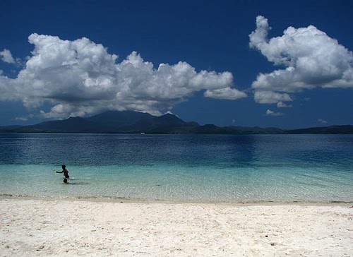
The city is also famous for Timoga Springs. It is well-known for the ice-cold, crystal-clear and none-chlorinated springs that flow freely all the way to the numerous swimming pools of each of the resorts. The resorts are a popular place for easing out the hotness of the summer heat. These five cold-spring resorts are all located along the national highway at 500 to 1 km (1 mi) before the Barangay of Buru-un and are accessible to all walks of life as they offer entrance fees that are affordable and easy to reach for the general public. The Bucana beach, located along the highway, halfway between Suarez and Buru-un is one of the more accessible ocean beaches in the city, although the best beaches are found further along the road in the province of Linamon.

Iligan City is Lanao Del Norte's main shopping district with the recent opening of Gaisano Citi Super Mall which is considered to be one of the largest Gaisano malls in Mindanao. Other department stores for shopping are the Old Gaisano Department Store, Trendline Department Store, Iligan Fiesta Mall, Unicity, Squareland Shopping Center, Berds Theater Mall and Jerry's Shoppers World. Unitop is positioning a local branch in the city at the former Boys Scouts of the Philippines' building at Quezon Avenue.

The City has various hotels such as the Maria Cristina Hotel, Elena Tower Inn, Farrah Hotel ,Cheradel Suites and Famous Pensionne House(which has two branches). It also has numerous motels such as the newly opened D'Morvie Motel, Casa Royale (1 and 2) and Celadon Pensionne House. The city also has several drive-in motels such as Lovingly Pensionne House, Citi Best 1 (Pala-o) and Citi Best 2 (Hinaplanon).

Aside from the waterfalls that the City of Iligan boasts of, other places of interest are the newly renovated City Public Plaza, The Centennial Park, Maze Parks and Resorts, the Buhanginan Hills (within premise of the City hall), and Saint Michael's Cathedral.


Iligan City is known not only for its rich natural resources but also for the wealth of the culture that abounds in the area. Majority of Iligan's people come from the Visayas and migrants from the other places of Mindanao. Iligan is literally and geographically located at the crossroads of rich culture – the Maranaos of Lanao Sur, Higa-unons of Bukidnon, the dominantly Christian settlers and migrants. It is proud of the peaceful co-existence of the varied cultural mix on its general community. Evidence of this peaceful co-existence is manifested during the annual celebration of the city fiesta honoring its miraculous patron saint, Saint Michael the Archangel.

The Diyandi (ritual dance) is performed only during the feast of Iligan Patron Saint, Senior San Miguel (Feast Day: September 29). Other curious dance-forms, also performed during the San Miguel Fiesta, include the Eskrima (a dance simulating a fight between San Miguel and his enemies, and the Yawa-yawa, literally, devil-devil), a dance from depicting the celestial battle between the forces of good and evil as impersonated by St. Michael, the Archangel and Lucifer.

Sometime in 1986, it was somehow felt by the local fiesta committee that there was a need to further popularize the folk-dance forms of the Iliganon. Thus was an idea born: the concept of a street dancing festival that will not only preserve certain traditional art forms but promote them as well. In an age when culture and tradition are battered by the incursions of modernity, the significance of such undertaking as a completion of traditional art forms cannot be belittled.

Now called the KASADYA (street dancing and merrymaking), which showcases these rich and varied cultural traditions. Highlighted by the traditional Diyandi, Eskrima and the street drama. KASADYA that was started, as a local form of entertainment has become a major tourist attraction of Iligan drawing crowds to about 50,000 people both local and tourist alike. It is considered as a non-income generating project having the most number of spectators both in the streets and in the showdown venue proper as compared to other tourism related activities.

It is to be noted that the San Miguel Fiesta focused on KASADYA was acclaimed by the BBC Holidays (a monthly consumer magazine published in the United Kingdom and the only publication officially endorsed by the prestigious British Broadcasting Corporation) as a tourist destination. It cited the tribal pageantry mixed with Christian piety famous with brightly costumed participants miming a fight with unseen adversaries to cries of "Viva Senior San Miguel". Other participants, dressed as warrior angels, march solemnly. It added that it is very unique because of the miracle play called the Yawa-yawa, performed in vernacular dialogue and depicting Lucifer's unsuccessful revolt against God and the good angels. Other national and local publications also cited KASADYA as a tourist attraction in Iligan.

Monday, July 19, 2010

Tagbilaran City, Bohol, Philippines


Tagbilaran City is a 1st class component city in the island province of Bohol, Philippines and serves as its capital.

It is the principal gateway to Bohol and is known as the "City of Friendship". Tagbilaran is considered by the Institute for Solidarity in Asia as one of the eight (8) Philippine Dream Cities, along with Samal, San Fernando, La Union, Cebu City, Iloilo City, Marikina, Naga, Calbayog City and Surigao City. It was also recognized as one of the (20) "Most Competitive Cities in the Philippines" and "Pinoy Cities on the Rise" in 2005 and 2007, and First in the Quality of Life Category for the same 2 years, awarded by the Asian Institute of Management (AIM) Policy Center.

History

A hundred years before Spaniards arrived in the Philippines, the settlement of which eventually became Tagbilaran City was already involved in trading with both China and Malaysia. This early settlement had contact with the Spaniards in 1565, when the Spanish conquistador Miguel López de Legazpi and the native chieftain Datu Sikatuna pledged peace and cooperation through the famous blood compact.

(San Jose de) Tagbilaran was established as a town on February 9, 1742, when it was separated from the town of Baclayon. The town was dedicated to St. Joseph the Worker. Since then it was part of the province of Bohol until it became a chartered city on July 1, 1966 by virtue of Republic Act No. 4660.

The city was occupied by the United States during the Philippine-American War, and by Imperial Japan during World War II.

Historical events

One of the most important historical events in Philippine History and immortalized in canvass by the famous Filipino painter Juan Luna is the Blood Compact between Datu Sikatuna, a local native chieftain, and Captain Miguel López de Legazpi, the Spanish explorer and colonizer. It took place in the coast of Bool, now a district of Tagbilaran, on March 16, 1565, a day after Legazpi and his crew of conquistadores on four ships chanced upon the shores of Bool during the course of their trip to the province of Butuan from Camiguin Island because of strong southwest monsoon winds and low tide. On that day, March 16, 1565, Captain General Miguel López de Legazpi, with Fray Andres de Urdaneta and some of his crew set foot on land for an audience with the local chieftain Sikatuna. The two bands of different race and creed met a few hundred meters away from the beach and after a few pleasantries, the Basque seafarer and the native chieftain of Bool sealed and strengthened their treaty of friendship in a historic Blood Compact. Sikatuna and Legazpi each made a cut on the left arm and collected the drop of blood into a single vessel and mixed with wine. To honor this treaty of friendship, the late President Elpidio Quirino established the "Order of Sikatuna", a presidential award and decoration conferred upon visiting dignitaries. A historical marker now stands on the very spot where Sikatuna and Legaspi perpetrated that famous Blood Compact.

Another significant event that took place during the Japanese Occupation was the Battle of Ubujan wherein a guerilla unit under the command of Captain Francisco Salazar,a.k.a. Vicente Cubello, engaged Japanese troops against overwhelming odds. It was a display of Boholano bravery against the well-equipped, well-trained Japanese soldiers.


Transportation


One of Cebu Pacific's Airbus A319 Landing at Tagbilaran City.
CPG Avenue, Tagbilaran City

Air

The city and the entire province of Bohol is mainly served by Tagbilaran Airport. Cebu Pacific Air using Airbus A319 have (2) flights daily, Philippine Airlines using Airbus A320 have (3) flights daily, Zest Airways using Airbus A320 has (1) flight daily plus an additional flight every Tue/Wed/Sat and Airphil Express using Airbus A320 has (1) flight daily starting 28 October 2010 to Manila. Flights to and from Tagbilaran to Manila takes around 1 hour and 15 minutes. There are no commercial flights out from Tagbilaran City to other destinations in the Philippines.

Sea

The Tagbilaran City Tourist Port serves boats plying the busy Cebu-Bohol sea traffic and major port cities in Mindanao. A fastcraft ferry ride from Cebu would take about 1.75 hours. OceanJet with (5) trips daily, SuperCat with (3) trips daily and Weesam Express with (4) trips daily are the fastcraft companies plying the Tagbilaran City to Cebu City route.

Land

Transportation within the city consists of tricycles, multicabs, jeepneys, buses, taxis and vans. Multicabs and jeepneys ply the longer routes while taxis and vans-for-hire are usually used for out-of-town travel. All of them are found in the Tagbilaran City Integrated Bus Terminal in Dao District. Bolanios Bus Lines, Mega Bus Lines, UltraBus Lines and Silver Star Bus Lines are the bus companies plying the Tagbilaran City to Metro Manila (Pasay City / Cubao, Quezon City) route with each bus line having at least (1) daily trip.

Economy

The City of Tagbilaran has that relative advantage as Bohol's main business capital and center of governance, education and transportation. It is on this climate that commerce and trade is very promising in the City, nonetheless, business activities also thrives in Port Towns (e.g. Ubay, Tubigon, Talibon, Jagna) known to be growth centers of the province.

Many residents of Tagbilaran City are considerably moneyed, but when it comes to business development, they become investment-shy. It is observable that dollar earners and entrepreneurs would rather save and bank their money rather than invest them for business endeavor. In the light of this situation, the inflow of investments from foreign investors are steadily pouring in to finance business ventures especially in the area of tourism.

The two local food delicacies, Peanut Kisses and Edelweiss torta, were started and promoted by the Alvarez family.

For a City its size, Tagbilaran ironically has more than 20 different banking institutions serving its populace as well as the entire province. This is due to the "thriftiness" attitude of Bol-anons and remittances received from locals working abroad who hail from the city and other towns in Bohol. The average household income is P 141,028.00/annum in 12,876 households.

Thursday, July 15, 2010

Camotes Island, Cebu, Philippines


Camotes Islands


The Camotes Islands are a group of islands that form part of the province of Cebu, in the Philippines. The island group is located east of Cebu Island, southwest of Leyte Island, and north of Bohol Island.

The Camotes is composed of the following four islands and their municipalities:

* Poro: the municipalities of Poro and Tudela.
* Pacijan: the sole municipality is San Francisco.
* Ponson: the sole municipality is Pilar.
* Tulang: is part of the barangay Esperanza, which is part of San Francisco.

The islands of Pacijan and Poro are connected by a paved road called a causeway. Ponson is separated by the Camotes Sea, lying about four kilometers northeast of Poro. Tulang is located off the northern tip of Pacijan.

The Camotes are low-lying islands. There is only one hill on Pacijan and another hill on Poro. These hills are used by a telecommunications company for relay stations. Pacijan has a fresh-water lake around two kilometers in length. Palm trees are the dominant plant on the islands. There are also numerous native varieties of fruit trees and other plants.

History

In 1942, the occupation from the Japanese forces taked in Camotes Islands in Cebu.

In 1945, the liberation was taken by the Philippine Commonwealth Army troops landed in Camotes Islands in Cebu we fronted the battles against the Japanese forces in the Battle of Camotes Islands during World War II.


Economy

The predominant industries on the Camotes Islands are farming (including corn, rice, pigs, chicken and cattle), fishing and tourism.

A number of tourist resorts have been established, catering to both domestic and international visitors. These include Santiago Bay Garden & Resort, Mangodlong Rock Resort and Green lake Park.

Origin

The word camotes is Mexican for sweet potatoes.

Languages

Porohanon or Camotes Visayan is spoken in the town of Poro only. The dialect is very similar to the dialect of Cebuano which is spoken in the rest of Camotes Islands and throughout the province of Cebu, Northern Mindanao and other parts of the Visayas. Porohanon is distinguished by the way the locals substitute the /y/ sound for /z/. Example: Maayong buntag (good morning) in Cebuano would be changed to Maazong buntag in Porohanon. Na-a diha (in cebuano), Ara dira ( in porohanon )

OUR FOOD

ASADONG ALIMASAG

2 malalaking alimasag, hinalabos at hinati sa dalawa
1 maliit na ulo ng bawang, pinitpit
1 katamtamang laking sibuyas, tinadtad
3 maliliit na kamatis, tinadtad
1/2 tasang tubig
1/3 tasang suka
1 kutsaritang pamintang durog
2 kusarit ang asin
1/4 kutsaritang betsin

Kunin ang alige ng alimasag. Itabi. Igisa ang bawang hanggang mamula; isama ang sibuyas, kamatis at tubig. pakuluin nang ilang minuto. Idagdag ang suka at timplahan nang asin at betsin. isama ang itinabing alige at luytuin nang sandali habang patuloy ang halo.

videokeman mp3
Imagine Me Without You – Jaci Velasquez Music Code


LYRICS

Imagine Me Without You – Jaci Velasquez Music

As long as stars shine down from heaven
And the rivers run into the sea
Til the end of time forever
You’re the only love I’ll need

In my life you’re all that matters
In my eyes the only truth I see
When my hopes and dreams have shattered
You’re the one that’s there for me

When I found you I was blessed
And I will never leave you, I need you

Chorus:
Imagine me without you
I’d be lost and so confused
I wouldn’t last a day, I’d be afraid
Without you there to see me through

Imagine me without you
Lord, you know it’s just impossible
Because of you, it’s all brand new
My life is now worthwhile
I can’t imagine me without you

When you caught me I was falling
You’re love lifted me back on my feet
It was like you heard me calling
And you rush to set me free

When I found you I was blessed
And I will never leave you, I need you

Chorus

When I found you I was blessed
And I will never leave you, I need you oh

Chorus

I can’t imagine me without you

Wednesday, July 14, 2010

Puerto Princesa City, Palawan, Philippines


Palawan is the most well preserved major island group in the Philippines. It is also the largest province in the Philippines in terms of land area. The rain forest, caves, coral reefs, mangroves, beaches and clear blue waters are its best assets. One has to go around the islands of Palawan to see how its people and the local government’s conservation efforts have born fruit. With over 1,700 islands and islets and almost 2,000 kilometers of coastline, Palawan is known as having one of the most beautiful seascapes in the world. Sprawled beneath the seas are nearly 11,000 square kilometers of coral reefs. Palawan was proclaimed as a fish and wildlife sanctuary in 1967 and to this day, this group of islands is probably the most protected province in the whole Philippines.


The Calauit Wildlife Sanctuary in the northern Calamianes islands is home to exotic and endemic species of animals that roam freely in its verdant hills and plains. Palawan is the home of Palawan Monkeys, Palawan Parrots, Palawan Bear cats, Palawan Peacock, Mongoose, Scaly Ant Eater, Porcupine, and mouse deer. A must see is the Puerto Princesa Subterranean River National Park (also known as Sabang’s St. Paul Subterranean National Park). It is a wonder to behold; carved by nature for millions of years; the length of cave and river network is unknown up to this day. The cavern stretches away in an almost perfect rectangle with walls and ceiling decorated with natural carvings in many colors. Stalactite and stalagmites seem like they have been intentionally crafted to awe the visitors. Further inside, one reaches a grand chamber, decorated with multi faceted colored stones. One has to be there to see its grandeur.


Puerto Princesa City (Filipino: Lungsod ng Puerto Princesa), the capital of Palawan, is a first class city in the Philippines. According to the 2007 census, it has a population of 210,508 people in 33,306 households. It is famous for its crocodile farm, underground river and numerous dive spots. It is also the second largest city in the Philippines (after Davao City) in terms of total land area. The outlying parts of the city contain the hometown of the former House Speaker Ramon Mitra, Jr..

The Puerto Princesa Subterranean River National Park, a UNESCO World Heritage Site, features a spectacular limestone karst landscape with its underground river. A distinguishing feature of the river is that it flows directly into the sea, and the lower portion of the river is subject to tidal influences. The area also represents a significant habitat for biodiversity conservation. The site contains a full mountain to the sea ecosystem and protects forests, which are among the most significant in Asia.

On 30 June 1992, Edward S. Hagedorn was elected Mayor of the city and completed his three term limit of three years for every term. In November 2002, Hagedorn was re-elected as mayor of the city.

As the city was recently declared a highly-urbanized city[1], per Section 29 of the Local Government Code of the Philippines, it is no longer under the administrative supervision of the provincial government of Palawan, and its residents are no longer eligible to vote for provincial officials.[2]

Geography

Puerto Princesa City lies at the mid-section of the long strip of Palawan Island province. It is approximately 306 nautical miles from Manila, 206 nautical miles to Panay Island and about 250 nautical miles to Zamboanga. It is bounded on the north by the municipalities of San Vicente and Roxas and on the south by the municipality of Aborlan. To its west is the South China Sea while to the East lies the Sulu Sea.
A 1904 nautical chart of Puerto Princesa's harbor

Total land area is 253,982 hectares stretched over 106 kilometers long with the narrowest breadth of 8.5 kilometers in Barangay Bahile.

Puerto Princesa City has 35 urban and 31 rural barangays, a total of 66 barangays.


History

Folk etymology attributes the name "Puerto Princesa" to a princess-like maiden who in the early days is said to have roamed around the place on certain nights of the year. On the other hand, practical people attribute the name to the geographical advantages of the place as a seaport – naturally protected the whole year round and endowed with a depth that can accommodate any size of shipping – a royal heaven for vessels or a virtual princess of ports as thus indicated by Spanish Colonizers on the country’s map.

Historically, the place was named after Princess Asunción, born in 1864 to Queen Isabella II and her consort, Francisco de Cádiz. When the princess suffered an untimely death, the Queen changed the name to Puerto de la Princesa. Eventually, the name was reduced to Puerto Princesa as it is known today.[3]

Spanish Colonizers founded the settlement on 4 March 1872 in the course of their exploration of the province. As they scanned the Palawan shoreline for a capital site, they came upon a hill with steep declivity. Rowing to shore, they surveyed the hill and discovered an extensive plateau which they decided as ideal for settlement.

Soon after, Fr. Antonio Muro levelled a portion of the hill to make way for a chapel. (That section is now occupied by the Catholic Cathedral, the P.C. Barracks and the Rizal Park. The Old Municipal Building used to be there, as well as an Elementary School). The first mass celebrated in Puerto Princesa took place at a site where a marker now stands.

In May 1872, the port became the center of Spanish Naval Operations in the area because the few natives were peaceful and the Bay met all the Navy’s requirements. Royal Decrees later provided incentives to settlers, such that by 1883 settlement had flourished into a town of twelve roads, a hospital and well-built port.

In 1894, Puerto Princesa was recognized by government authorities as one of the most beautiful towns in the country by virtue of the orderly distribution of streets, buildings and houses as well as the cleanliness of the community.

In 1911, the New American Administration made Puerto Princesa the seat of the Palawan Provincial Government with Major John Brown as Lieutenant Governor.

The town was converted into a city on 1 January 1970 under R.A. 5906 as amended by P.D. 437, through the effort of then Congressman Ramon V. Mitra, Jr. Feliberto R. Oliveros, Jr. became the first City Mayor.

Since its foundation, Puerto Princesa has been the nerve center of activities in Palawan. Aside from being the seat of public administration, it is the heart of trade, commerce, service, and industry in the province.

Today, under the leadership of Mayor Edward S. Hagedorn, the City has gained the distinction of being a model city – in cleanliness, environmental protection and conservation, and local governance in general.

And so, with a responsive leadership and an inspired citizenry, the tradition of Puerto Princesa being a beautiful and clean city lives on.

People and Culture

Waves of migrants from other Philippine provinces, and even other countries, have turned Puerto Princesa into a melting pot of various cultures. Among the original inhabitants are the Cuyonons who have a rich legacy of folklore and traditions. Indigenous groups include the Tagbanwas, Palawanos, Molbogs and Bataks, each group with its distinct culture and system of beliefs.

Total inhabitants number about 161,912 (as of May 2000), Three fourth of the population resides in the city proper, an urban settlement on the shores of Puerto Princesa Bay. While Cuyonon is widely spoken, the predominant language is Tagalog; Visayan, as well as English are widely spoken.

Naga City, Bicol


The City of Naga (Bikol: Ciudad nin Naga; Filipino: Lungsod ng Naga) is a city of the Philippines. Located in the Bicol Region, a peninsula on the southeasternmost tip of the island of Luzon, it is 377 kilometers southeast of Manila, the nation's capital, and about 380 kilometers northeast of Cebu City

It is the most densely-populated city in the region, and is locally known as the "Heart of Bicol". It is the commercial, financial, educational, religious and cultural center of the Bicol region. Residents of the City are called Nagueños.

Naga City is at the core of Metro Naga, an unofficial designation given the city and 14 municipalities in the area administered by the Metro Naga Development Council. MNDC covers the entire 2nd district of the province of Camarines Sur, and part of its 1st, 3rd and 4th districts.

History
Naga Metropolitan Cathedral officially know as the Metropolitan Cathedral of Saint John the Evangelist
Peñafrancia Shrine
Holy Rosary Minor Seminary

Before the coming of Spanish conquerors, Naga was already a flourishing village along the banks of the Naga River. It was an important village with comparatively sophisticated weaponry and surprisingly advanced culture.

For hundreds of years during the Spanish colonial era, the Naga that we know now was once the center of trade, education and culture, and the seat of governmental and ecclesiastical jurisdiction in Bicol and parts of modern Southern Tagalog and Central Luzon.

In 1573, on his second expedition to this region, the conquistador Juan de Salcedo landed in a village and named it "Naga" because of the abundance of Narra trees ("Naga" in Bikol) in the place, although some local historians now believe the term naga came from a similar word found in the languages of the Bataks of Sumatra and the Dayaks of Borneo, meaning "serpent/dragon". The same word is found in other Philippine languages and according to local historian Danilo Gerona, the ancient Tagalogs and Pampangos used a decorative figurehead on the prows of their seacrafts in the shape of the head of a dragon or snake which they called naga. In 1575, Captain Pedro de Chávez, the commander of the garrison left behind by Salcedo, founded on the site of the present business center (across the river from the original Naga) a Spanish city which he named La Ciudad de Cáceres, in honor of Francisco de Sande, the governor-general and a native of the city of Cáceres in Spain. It was still by this name that it was identified in the papal bull of August 14, 1595 that erected the See of Cáceres, together with those of Cebú and Nueva Segovia, and made it the seat of the new bishopric under the Archdiocese of Manila.

In time, the Spanish city and the native village merged into one community and became popularly known as Nueva Cáceres, to distinguish it from its namesake in Spain. It had a city government as prescribed by Spanish law, with an ayuntamiento and cabildo of its own. At the beginning of the 17th century, there were only five other ciudades in the Philippines. Nueva Cáceres remained the capital of the Ambos Camarines provinces and later of the Camarines Sur province until the formal creation of the independent chartered city of Naga under the Philippine Republic.

The bishops of Cáceres occupied a unique place in the Philippine Catholic hierarchy during most of the Spanish regime. By virtue of the papal bull of Gregory XIII, ecclesiastical cases originating in the Spanish East Indies, which ordinarily were appealable to the Pope, were ordered to be terminated there and no longer elevated to Rome. Decisions of bishops were made appealable to the archbishop and those of the latter to the bishop of the nearest see. Thus, in the Philippines, the decisions of the Archbishop of Manila were subject to review by the Bishop of Cáceres whose jurisdiction then extended from the whole Bicol region, the island-province of Marinduque and the present-day Aurora, which was once part of the former Tayabas province, which is now the province of Quezon. In this sense, bishops of Bikol were delegates of the Pope and could be considered primates of the Church of the Philippines.

This was the reason why bishops of Cáceres and archbishops of Manila were sometimes engaged in interesting controversies in the sensational Naga case and in such issues as canonical visitation and the secularization of the parishes. As papal delegate, Bishop Francisco Gaínza, then concurrent bishop of Cáceres, sat in the special ecclesiastical tribunal which passed upon the civil authorities' petition to divest Fathers Burgos, Gómez, and Zamora of their priestly dignity. Gaínza did not only refuse the petition but also urged their pardon.

With the advent of the American rule, the city was reduced to a municipality. In 1919, it lost its Spanish name and became officially known as Naga. It acquired its present city charter in 1948, and its city government was inaugurated on December 15 of the same year by virtue of Republic Act No. 305. Rep. Juan Q. Miranda sponsored this legislative act which put flesh into the city's bid to become among the only few independent component cities in the country.

Situated at the center of the Bikol peninsula and surrounded on all sides by rich agricultural, forest and fishing areas, Naga is also at the confluence of the Naga and Bikol Rivers. Thus, it has always been an ideal place for trade and as center for schools, church and government offices.

Transportation and Communication

Naga City is easily accessible by air and land. The city is served by the Naga (WNP) National Airport which is located in the provincial capital of Pili. Flights from Ninoy Aquino International Airport to Pili takes approximately 35–40 minutes. Cebu Pacific and Air Philippines fly directly from NAIA three and two times a day, respectively. By land, Naga is a 7- to 8-hour ride from Manila via Quirino & Andaya Highways or 10 hours via the Maharlika Highway. It is approximately 22 hours from Cebu City with ferry transfers in Sorsogon, the southernmost province of the Bicol peninsula. Daily rail services to and from Manila were provided by the Philippine National Railways but these were temporarily discontinued due to systems upgrading.

Naga is well-served by several telephone and mobile phone companies. Bayantel and Digitel are the main telephone operators in the city. Other companies which compete keenly for the city's telecommunications market have also put up calling stations scattered all over the city. These are PLDT, PT&T, among others. Major mobile phone operators Globe, Smart, and Sun Cellular enjoy wide patronage.

ABS-CBN had expanded its network in Bicol by putting up ABS-CBN Naga. Local shows such as TV Patrol Bicol, Marhay na Aga Kapamilya and MAGTV Oragon are aired in the whole region via ABS-CBN Regional Network Group which is also stationed in the city. ABC5 also airs shows in the city through its affiliate station People's Broadcasting Network (PBN TV 5 Naga). GMA7 and QTV 11 will soon air their local shows in the region. [1]

Naga City has the most number of radio stations of any locality in the region, some of which operate 24 hours daily. These include MOR 93.5 FM Naga , RMN DWNX-FM , GMA's Campus Radio 101.5 Naga. The city's cable and satellite TV companies include Naga Cable TV and Caceres Cable TV and SkyCable is also available.

Culture
[edit] Colonial Spain influence

The city celebrates the Feast of Nuestra Señora de Peñafrancia Our Lady of Peñafrancia, the Patroness of the Bicol Region, starting second Friday of September each year. The start of the feast, which is the largest Marian devotion in the country, is signalled by a procession (called Traslacion) which transfers the centuries-old image of the Blessed Virgin Mary from its shrine at the Peñafrancia Basilica Minore to the 400-year old Naga Metropolitan Cathedral. Coinciding with nine days of novena prayer at the cathedral, the city celebrates with parades, pageants, street parties, singing contests, exhibits, concerts, and other activities. Finally, on the third Saturday of September, the image is returned shoulder-borne by so-called voyadores to the Basilica Minore de Nuestra Señora de Peñafrancia via the historic Naga River.

Tourism
Malabsay Falls
Fluvial Procession of Ina
Divino Rostro
Nuestra Señora de Peñafrancia

According to the Department of Tourism arrival statistics in Bicol, Naga City and Camarines Sur combined are the top tourist destination in Region V, outclassing the province of Albay/Legazpi tandem. The province registered a total of 258,608 visitors from January to December 2006 133,604 visitors in Albay/Legazpi on the same period. The Bicol's premier city and province have jointly breached that mark, posting 350,944 tourist arrivals for the period of January to September 2007 alone. A remarkable increase of 114%. Tourist arrivals in Albay and Legazpi combined only recorded a total of 126,897 for the same period or only an 18% improvement from last year's record.

The Camarines Sur and Naga City tandem is without doubt, the new tourist hub in the Bicol Region. Naga City and CamSur was described in the newest edition on Lonely Planet traveller's guide as "Luzon's best kept secret". The regional office of the Department of Tourism attributed the increase to the full operation of the world class Camarines Sur Watersports Complex in the town of Pili and Naga City's sustained tourism intervention program.

Other suggestions for those who would like to have a nature getaway will be the Mini Hydro Hot Springs at Brgy. Panicuason and Magic Splash Resort along Carolina. The City of Naga will be most welcoming to tourists all over the world. Some of the famous places and activities to visit include:

Baybay City, Leyte, Philippines


Baybay is city located in the province of Leyte, Philippines. It is often called by the locals as the "City of Baybay" and it is preferred by the local government officials. It is the largest city in the province in terms of land area. Covering an area of 46,050 hectares, Baybay is composed of 92 barangays, 23 of which are in the poblacion. The remaining 69 are rural barangays. It is situated on the western coast of the province of Leyte.

It has a Type 4 climate, which is generally wet. Its topography is generally mountainous in the eastern portion as it slopes down west towards the shore line. Generally an agricultural city, the common means of livelihood are farming and fishing. Some are engaged in hunting and in forestal activities. The most common crops grown are rice, corn, abaca, root crops, fruits, and vegetables. Various cottage industries can also be found in Baybay such as bamboo and rattan craft, ceramics, dress-making, fiber craft, food preservation, mat weaving, metal craft, fine Philippine furniture manufacturing and other related activities.

Baybay is a major port city on the central west coast of Leyte, Philippines, where ferries leave for Cebu and other islands. With the mountains in the background and the typical old Spanish church with the nice bell tower dominating the town, it makes a most attractive and beautiful picture seen at dawn from a ship just arriving in port.

Baybay has great potential as a tourist destination, especially for tennis players. It is not only rich in biodiversity and history it also houses the campus of the Visayas State University. Likewise, it has river systems fit for river cruising, numerous caves for spelunking, forests, beaches, and marine treasures. This richness coupled with the friendly Baybayanos will be an element for a successful tourism program. Considering the role of tourism in development, Baybay intends to harness its tourism potential. It is also famous of its delicious marinated chicken barbecue served at the Restaurants located at the Baywalk wherein one can enjoy the seabreeze while munching the juicy and filling barbecues. It also has the taste of a highly urbanized city through a food chain (Jollibee-Baybay) which is known among Filipinos all throughout the globe.

According to the 2000 census, it has a population of 95,630 people in 19,517
households.


History

Baybay was believed to be the only settlement on the western coast of Leyte known to the first Spanish conquistadors that came with Magellan, as was Abuyog in the eastern part of the province, and Limasawa and Cabalian in the south. In 1620, the Jesuit fathers which belonged to the "residencia" of Carigara, the first and central station of the Society of Jesus in Leyte.

By superior approbation, Baybay was created a parish on September 8, 1835 with the invocation of Our Lady of the Immaculate Conception. However, the town was erected and independent parish on February 27, 1836.

When the Augustinians took over the administration of the parish after the expulsion of the Jesuits, they opened the first school in Baybay. During their time, the first road leading to Palompon was constructed, thus bringing Baybay closer to her neighboring municipalities. The Augustinian fathers stayed in the town for 75 years - all of which they devoted to the upliftment of the natives in education and in their economic standing.

The first church of Baybay was built in Barrio Punta where it still stands today but is in need of repair. Punta is one of the seven original barrios of Baybay and was even believed to be the original site of Baybay itself, although there are others who say that it was actually in Kabkab, in the vicinity of Barrio Pangasugan.

Chinese invaders attempted to conquer the community, but the brave and staunch natives foiled several attempts. When the Spanish conquistadors spread themselves out to the provinces, an expeditionary force under Felipe Segundo, evidently looking for a bigger settlement, landed in a barrio north of the town which was and still is called Pangasugan. Landing near the river, he pointed to a spot and asked a native in Spanish for the name of the place. Unable to understand Spanish and thinking that Felipe Segundo wanted to ask about the river, he answered in Visayan, " Ang suba nagbaybay sa Pangasugan." This is how Baybay is believed to obtain its name. However, Fegaffeta's chronicle during the Voyage of Magellan to the Philippines clearly showed that the place is already known as Baybay when they sailed from the southern part of the island of Leyte to the island of Cebu.

Baybay also suffered from Moro raids. On October 22, 1605, one such raid occurred and the pirates, after leaving countless dead, carried off 60 men as captives. Again, on November 4, 1663, moors under the dreaded Corralat took their toll of human lives and captives after mercilessly slaughtering the handful of men who defended the town with the aid of the parish priest.

Baybay suffered a great setback in 1866 when a great fire practically reduced the town to ashes leaving only the chapel of the Holy Cross in a miraculous manner.

The civil administration of the town during the Spanish era was placed in the hands of the gobernadorcillo, assisted by a teniente and the different jueces and cabezas. In 1892, in accordance with the provisions of the Mayura law, the head of the municipal government was given the designation of "Capitan Municipal" and his assistants in office were called "teniente mayor indice" and the "teniente de policia." For the first time, a juez de paz was designated and a detachment of guardias civiles was placed in the town.

The construction of the church, which still stands today, was begun under the engineering administration of Mariano Vasnillio during the term of Fr. Vicente E. Coronado in 1852. The construction lagged for ten years after which the work was resumed under Maestro Proceso, who came from Manila for the purpose of finishing the work. The church was finally finished in 1870 after Capitan Mateo Espinoso, a sculptor and painter of renown, put on the finishing touches. The altar and the rails as they stand today are a credit to his genius.

As the Spanish residents moved away in the early months of 1898, the reins of local government passed completely into the hands of the Filipino officials. An election was held and Don Quirimon Alkuino was elected as the first Filipino presidente. However, after about four months, Gen. Vicente Lukban nullified the results of the election and ordered another one to be held, with the same results. Lukban ordered that the barrios of Baybay be named after the tenientes, thus Caridad was renamed "Veloso," Plaridel became "Alvarado," Bitanhuan was named "Coronado." San Agustin "Sabando," Punta "Virgineza," Pomponan "Montefolka," Gabas "Bartolini", etc.

Throughout these years, Baybay developed into one of the biggest towns in Leyte.

The port of Baybay was closed in 1899 by the American coast guards. The price of commodities soared and products like copra and hemp accumulated in the docks. The order was lifted, but only after 14 ships, the greatest number to dock in port at one time, had stayed in port for days waiting for the order to leave.

On February 10, 1901, the first Americans arrived in Baybay on the ship "Melliza", their arrival caused great confusion and the people evacuated to the barrios. Only a few officials stayed in the town. The next day, soldiers scoured the countryside convincing the people to return to their homes.

Even while the local government was under Don Quirimon Alkuino, he was under orders to follow Capt. Gilmore's (commander of the American attachment) advice. Eventually, this caused conflicts in the local government, and Filipinos took to the hills to join the fight against the Americans.

There were several attempts to attack the American garrison in the town, but practically all of them failed because the Americans had superior arms. Don Guilermo Alkuino and Don Magdaleno Fernandez led the first attack with more than 200 men. The American soldiers fought another in Barrio Pomponan that resulted in the death of 30 men and the destruction of the barrio.

A group of Hilongosnons under the renowned Francisco Flordelis made an attempt in 1901 but they were driven off in a battle at Barrio Punta.

Filipino nationalist made Baybay one of the areas where they made their last stand against the Americans. Later, the surrender ceremonies were held in the town, but only after numerous conferences between American officers and Filipino pacifists were held to effect the surrender of the resistance leaders. The surrender of Capt. Florentino Penaranda who was the last to give up the fight was a colorful one. All his men and officers, thousands of them, gathered at the banks of the Pagbanganan River. From there, they marched to the plaza in front of the municipal hall where the American officers were waiting. Before the Filipinos laid down their arms, Penaranda delivered a speech that even today is considered one of the most stirring addresses made in the province. To commemorate the event, a sumptuous banquet was held for the Americans and the Filipino nationalists. The following day, the Filipino soldiers trekked home in their uniforms to start another life of peace and work.

A sect of the Protestant religion entered Baybay for the first time sometime in 1900. They established their own church in the poblacion. In 1902, the Philippine Independent Church established itself in the barrio of Caridad; shortly afterwards, the Seventh Day Adventists came in.

At the turn of the century, a provincial high school was founded in Baybay, one of the first high schools in Leyte. The government also established the Baybay National Agricultural School for young farmers of Visayas and Mindanao.

The Japanese forces came to Baybay in two waves in 1942. A puppet government was established shortly after their arrival wherein Paterno Tan Sr. was the mayor.

In 1944, American planes passed the town in bombing missions in Cebu. They bombed a ship at anchor in the port of Baybay and left it in flames. The Japanese Imperial Forces left the town on October 19, 1944.

Baybay was used by liberation forces as a springboard for patrol units in the south and for forces that went north for the great battle of Ormoc, where a fierce battle was raging. The hospital was taken over by the provincial government and is still functioning today.

Baybay today is one of the biggest cities in Leyte in terms of land area. (The land area is 410.5 km2.) It leads in the category of a third class city in the province of Leyte.


Culture

Experience Baybay’s unique blend of culture reflected in its various traditions and its dialect. As a melting pot in the western part of Leyte, Baybay has developed an interesting mix of culture through the influence Cebuanos, Waray and the Surigaonons. And although most Baybayanos have adopted a modern lifestyle, they have retained their distinctive traits and traditions, which makes Baybay an interesting and pleasant place to visit.

The commercial service sector in the city is on the upswing. Banks,virtual assistance center, restaurants, cafes, night spots and sports centers dot the city. There are also many giftshops, videoshops, cellshops, pawnshops, bookstores and whole-sale stores around the city. The Baybay Barbecue Plaza is a long lane of food paradise for both travellers and locals. The City's Seaside promenade is the most visited lounging areas in the city.

Tuesday, July 13, 2010

Bais City, Negros Oriental


Bais City, Negros Oriental
A Brief History & Other General Information
Bais City, known as one of the major sugar producing cities in Negros Oriental is also now making waves in the tourism industry in the Philippines through its popular dolphin and whale watching tours.

Just 45 minutes way from Dumaguete, the capital city of Negros Oriental, Bais City is accessible by land travel, with public transportation readily available.

Bais is filled with history having been occupied by Spanish colonizers since the 16th century. The city is the home of the Central Azucarera de Bais, which was established in 1918 as the first of two sugar centrals of Tabacalera in the Philippines, which also pioneered in the manufacture of paper from bagasse. It is the CAB that propelled the province’s sugar industry into a top dollar earner.

Bais, with a land area of 30,000 hectares is situated along the south of Manjuyod in the north; Daco Island and Banlas Point in the east; Negros Occidental in the west; Tanjay and Pamplona in the south. It is well protected by Daco Island. Like many towns of Negros, Bais has volcanic soils suited for sugar; hence this town is the center of sugar growing district. Sugar, lumber, kapok, rice, and corn are its principal products. It has a healthful climate and a very short dry season.
A Brief History of Bais City

How Bais got its name is a legend in itself.

When the fertile flatlands and rich fishing grounds were reported to the Spanish colonizers after they arrived in the Philippines, an expedition headed by a Spanish engineer was sent to the area to get its name and pinpoint its exact location, as well as prepare a map of the island. They happened to enter the mouth of the river in the area and saw some people gathering the abundant fresh water eel locally called “Bais” that were caught in their fish traps.

Upon seeing the fishermen, the Spaniard asked in his native tongue: “Como se llama este lugar?” (What is the name of this place?). Failing to understand the engineer of course, and thinking that he was asking for the name of the fish caught, the fisherman answered curtly, “bais”. The Spaniard therefore, recorded the name “Bais” as the name of the place.

After the discovery of the island by the Spanish conquistadores, several of them moved to Negros on account of the high fertility of the flatlands of Bais. Many came and settled in the area and planted sugar cane, thus producing “moscovado” (sugar from their mills) which was exported to Spain via Iloilo, which then was the principal shipping point in the Visayas. This was loaded in large sailboats called Lurcha or Batel.

On January 20, 1848, Gov. Gen. Don Narciso Claveria entrusted the Island of Negros to the Recollects, then sent Missionaries to Negros in 1849. Bais was created as a town in 1849. In 1850, Bais was only a visita under the civil and ecclesiastical jurisdiction of the town of Tanjay. Later, it became a barrio of Manjuyod with the tribunal as its only strongly built structure.

The first village chapel was built of light materials and the construction of a concrete church started only in 1850 when Father Guillermo Garcia del Carmen became parish priest. In 1885, Father Manuel Alonzo took over the parish.

In 1865, hydraulic mills were installed in Bais, Bago, Bacolod, La Carlota, Pontevedra, Granada, Minuluan and Silay; Altogether they were capable of milling 100 piculs of sugar in 12 hours. These machineries replaced the primitive wooden mills. From 1865, the progress of Bais started with such increasing economic activities, particularly in sugar production, until 1896 when the Philippine Revolution broke out.

The Revolution in Negros started in November 5, 1898, Gen. Juan Araneta led the resistance movement against the Spaniards. Two days later, in Bacolod, the Spanish forces in Negros surrendered to Aniceto Lacson y Ledesma, Commander in Chief of the Filipino Forces in Northern Negros. A Cantonal Government was then established and Gen. Araneta became the Secretary of War.

When the American Forces arrived, Gen. Araneta counseled the Cantonal Government to submit to the American invaders. Occidental and Oriental Negros which were separated in 1890, were again united until the establishment of a civil government by Americans in 1901.

Bais became a bustling town after the war, when the Americans replaced the Spanish regime in the Philippines.

Negros Oriental became a province with the late Demetrio Larena of Bais holding the distinction as its first governor. It was during this epoch in 1901, that Bais realized a dream come true when she was raised politically from a barrio to a full town hood; Emilio Teves served as its first Municipal Mayor.

During World War II, Bais was the headquarters of the guerilla forces under Maj. Placido Ausejo, a constabulary officer. A Japanese garrison was stationed in the town for sometime. When the Americans landed in Dumaguete the enemy withdrew. Fierce fighting took place only in the southwestern coastline and mountain areas of Negros Oriental.

The town was created as a Charted City by virtue of Republic Act No. 5544. approved Sept. 9, 1968. Genaro Goni was the first city mayor.

On September 9, 1968, Philippine President Ferdinand E. Marcos officially and personally proclaimed Bais as a city.


GEOGRAPHY

Located on the eastern side of Negros Island, Bais City is bounded on the north by the municipality of Mabinay, Manjuyod on the northeast, Tanjay on the south, Tañon Strait on the east and Bayawan on the west.

Situated 45 kilometers north of Dumaguete City, Bais City has a total land area of 25,109 hectares or 5,202.67 sq. km..

Being the core of Negros Oriental’s sugar district, Bais City is home to one of the country’s pioneering mills, the Central Azucarera de Bais. The United Robina Sugar Mills Company is also found in here.

Local produce includes corn, vegetables, rootcrops, legumes, fish, prawns, shells, mollusks and Euchema seaweed or goso. Sugar cultivation is confined to 9,056 hectares, coconut at 3,120 hectares and corn at 3,060 hectares.

Prawn and bangus production are limited to wetland and shoreline areas covering 468 hectares while mangrove and nipa areas covering approximately 378 hectares are maintained as fish sanctuaries, wildlife preserves and buffer zones.


TOPOGRAPHY

Bais City, which comprises around 4.35% of the total land area of the Province of Negros Oriental, is predominantly rural. It is composed of 35 barangays, 13 of which are coastal, 5 barangays are in the lowlands, and the rest are hinterland barangays.